q4WsCvLajdd4
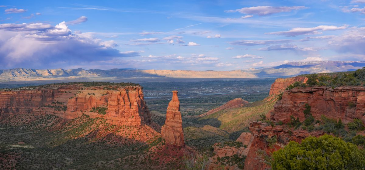
The Colorado Plateau is famous for broad mesas, deep canyons and richly coloured sandstone. Its scenery is also a geological archive. Layer by layer, the region records ancient rivers, deserts, shallow seas, changing climates, uplift and the persistent work of erosion.
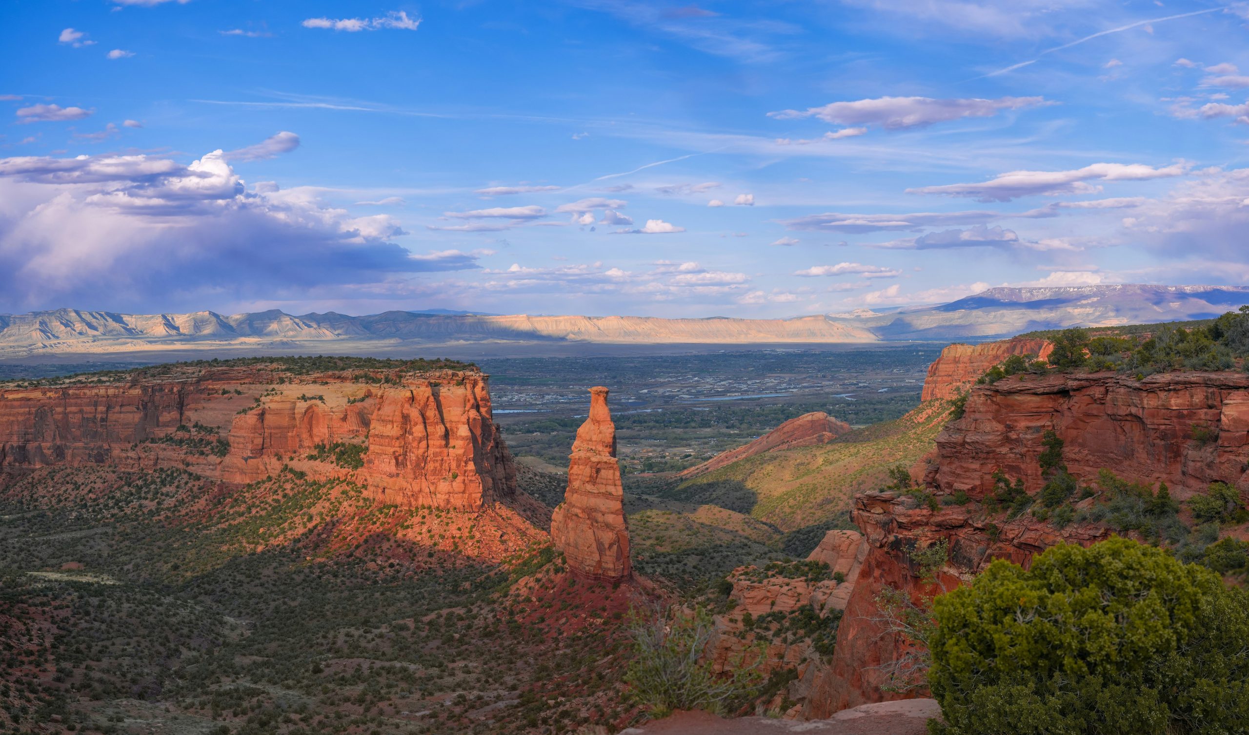
A layered record of ancient environments
Many of the plateau’s most recognisable cliffs and slopes are made of sedimentary rocks. Sandstone forms when sand grains are buried, compacted and cemented together. Mudstone and shale form from finer sediment, while limestone can accumulate in marine environments where carbonate material is produced or precipitated.
Different formations represent different environments. Some preserve evidence of river channels and floodplains; others record coastal settings, shallow seas or wind-blown dunes. Cross-bedding in sandstone can preserve the movement of ripples and dunes, while mud cracks may indicate that wet sediment was periodically exposed to air.
Why so many rocks are red
Red, orange and brown colours commonly arise from iron-bearing minerals. When iron is exposed to oxygen during weathering or sediment formation, iron oxides can coat grains and cement sediment. The exact colour depends on mineral type, grain coatings, cement and later alteration. Not every red layer formed in the same way, so colour is a clue rather than a complete environmental diagnosis.
In some formations, pale bands or greenish-grey layers interrupt the red. These variations may reflect differences in sediment source, water chemistry, oxidation conditions or later fluid movement. Geologists compare mineral composition and sedimentary structures to understand why colours change from one bed to another.
Uplift made the hidden archive visible
The plateau’s sedimentary layers were deposited over immense periods, then elevated as regional tectonic forces reshaped western North America. Uplift increased the potential energy of rivers and helped them cut downward through the rock sequence. The Colorado River and its tributaries have carved deep valleys and exposed a vertical cross-section through the region’s geological history.
Erosion is not simply the removal of material. It reveals older rocks, creates cliffs and benches, transports sediment downstream and continually modifies drainage networks. The shape of a canyon depends on rock strength, fractures, river discharge, climate and the time available for incision.
Reading a cliff like a timeline
In an undisturbed sedimentary sequence, lower layers are generally older than the layers above them. This principle of superposition gives geologists a relative order of events. But a complete interpretation also considers faults, folds, intrusions and unconformities that may interrupt the sequence.
A field sketch can make these relationships easier to understand. Mark the main contacts, note changes in thickness and grain size, and look for channels or cross-bedding. Compare the observations with a geological map and published stratigraphic descriptions. The goal is to connect the visible landform to the processes that created it.
A landscape still changing
Weathering, runoff, flash floods, rock falls and river transport continue to shape the plateau. Vegetation and soil cover influence how water reaches the bedrock, while joints and bedding planes can guide the movement of water and the formation of cliffs. Modern processes operate on top of an older structure inherited from millions of years of geological change.
For visitors and students, the best way to appreciate the plateau is to treat each exposure as evidence rather than scenery alone. Observe the layers from a safe, permitted viewpoint, follow marked routes and avoid disturbing fragile formations. Photographs with a scale reference and notes about bedding, colour and grain size can turn a memorable view into a useful geological record.
The wider lesson of Southwest geology
The Colorado Plateau demonstrates how deposition, tectonics and erosion work together. Ancient environments build the layers; later forces lift and deform them; rivers and weather expose and reshape them. The result is a landscape where deep time can be read in the geometry of cliffs and the changing colours of rock.
Further reading: National Park Service — Grand Canyon geology; US Geological Survey.