q4WsCvLajdd4

The Rio Grande Rift is an extensive zone where the continental crust of the southwestern United States has been stretched. Its basins, fault scarps and volcanic rocks preserve a record of how continents respond when lithosphere is pulled apart.

The geological process
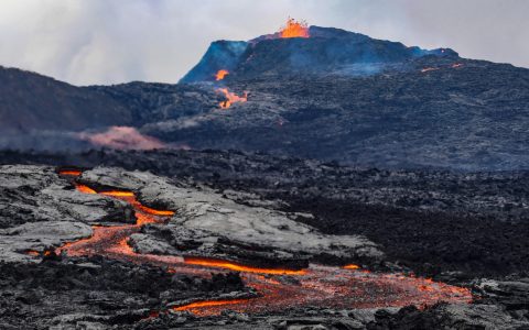
Extension thins the crust and creates normal faults. Blocks may subside to form sediment-filled basins while adjacent blocks remain elevated. Magma can rise through fractures, adding volcanic rocks and heat to the evolving rift system.
How researchers investigate it
Geologists combine seismic data, gravity measurements, boreholes, geochronology and surface mapping. These methods reveal basin depth, fault geometry, volcanic history and the changing thickness of crust beneath the rift.
What to look for in the landscape
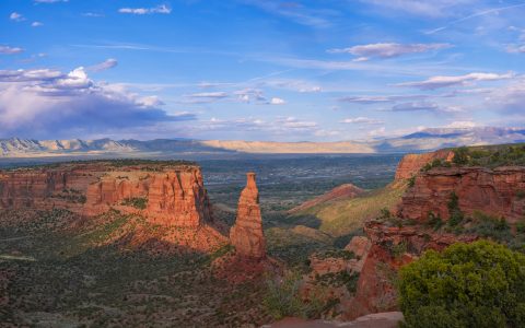
A field observer can compare basin floors with uplifted mountain blocks and look for tilted sedimentary layers or fault-related scarps. Regional maps help distinguish rift structures from older mountain-building features.
Limits and interpretation
The rift is not a single open crack and it does not have uniform extension everywhere. Different segments have different histories, and some faults may be inherited from older tectonic events.
Why the region or feature matters
The Rio Grande Rift is a natural laboratory for continental extension. Its geology helps explain basin formation, groundwater storage, volcanic activity and the long-term evolution of western North America.
Connecting local evidence to regional history
A single exposure rarely tells the whole story. Geologists compare nearby outcrops, topographic patterns and mapped rock units to determine whether a feature is local or part of a wider geological structure. This regional approach is especially important where younger soil, vegetation or sediment hides the bedrock contact.
A careful approach to geological interpretation
Descriptions should begin with what can be observed: rock type, grain size, layering, fractures, fossils and the relationship between units. Interpretations are stronger when they explain several observations at once and acknowledge evidence that does not fit the preferred explanation.
Further learning
Regional geological surveys, national park geology pages and university field guides provide maps and case studies for comparing this feature with other examples. Check the scale and date of each map, and distinguish a well-established geological principle from an interpretation that remains under discussion.
Estimated reading time: 4–6 minutes.