 q4WsCvLajdd4
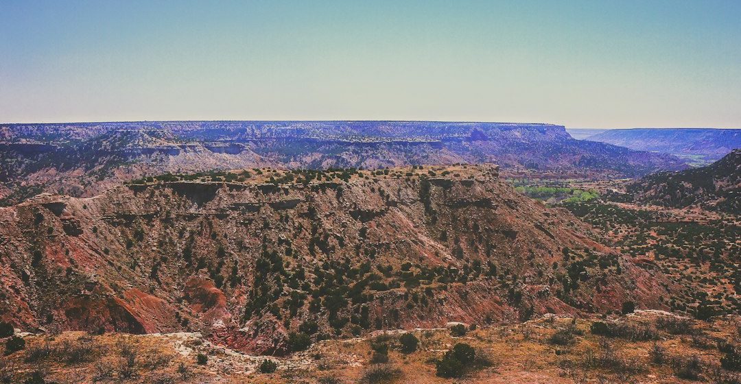
The Grand Canyon is often introduced as a spectacular example of river erosion, but its walls preserve a much longer story. Layer after layer records environments that existed long before the modern Colorado River began cutting the canyon. Reading those rocks reveals how the American Southwest shifted between seas, coastal plains, deserts and river systems over geological time.
A stack of changing environments
Many of the canyon’s upper and middle layers are sedimentary rocks. Sandstone may preserve evidence of wind-blown dunes or river channels; limestone can indicate deposition in warm, shallow marine water; shale and mudstone often form from fine sediment settling in quieter settings. These interpretations rely on sedimentary structures, fossils, mineral composition and relationships between layers.
The rock record is not a continuous diary. Some intervals are represented by thick deposits, while others are missing because sediment was never deposited or later erosion removed it. Boundaries that represent long gaps in the record are called unconformities.
Reading the clues in sandstone
Cross-bedding is a particularly useful feature in many sandstone units. It forms as ripples or dunes migrate and layers of sediment accumulate at an angle to the main bedding surface. Large-scale cross-bedding can indicate wind-blown dunes, while smaller structures may form in rivers or shallow water. Grain size, sorting and associated features help distinguish between these environments.
Desert deposits can preserve enormous dune sets, but a sandstone is not automatically evidence of a desert. Rivers, beaches and shallow marine systems also deposit sand. Geologists look for a combination of features rather than relying on rock name alone.
Marine intervals in an inland landscape
Several parts of the broader Colorado Plateau record periods when shallow seas covered areas that are now far from the coast. Marine limestones and fossil-bearing layers show that the region’s geography was very different from today’s arid plateau. Changes in sea level, basin subsidence and sediment supply influenced where these deposits accumulated.
As conditions changed, shorelines migrated and environments shifted. A vertical sequence from marine limestone to coastal sandstone and then to desert deposits can record a changing landscape through time, although the details vary between locations.
Why the layers are now so high
The Colorado Plateau was uplifted during a long and complex tectonic history. Uplift raised the region while much of its broad internal structure remained relatively intact compared with more intensely folded mountain belts. The Colorado River and its tributaries then incised into the elevated landscape, exposing a deep cross-section through the rock record.
Uplift and incision are related but distinct processes. Regional uplift changes the elevation and potential energy of the landscape; river incision depends on the river’s ability to erode and transport material. Climate, sediment load, rock resistance and base level all influence how a river responds.
How the canyon became a window into deep time
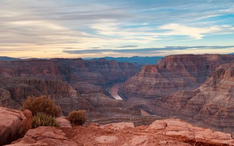
Weathering and erosion gradually widened the canyon and its tributary valleys, exposing layers that would otherwise remain buried. Resistant rocks may form cliffs, while weaker units tend to create slopes. This contrast produces the familiar stepped profile of the canyon walls.
The age of the rocks and the age of the canyon are not the same. Many exposed formations are hundreds of millions of years old, whereas the modern canyon’s incision history is much younger and remains an active subject of geological research. Different parts of the river system may also have different histories.
What to look for in the field
When viewing a canyon wall, trace individual layers laterally and note changes in colour, thickness and cliff-forming behaviour. Look for contacts between formations, visible bedding structures and places where tributaries expose additional sections. A field interpretation should connect these observations with regional maps and established stratigraphic descriptions.
A landscape that preserves change
The Grand Canyon is more than a dramatic landform. Its rocks record shifting environments, long gaps in deposition, regional uplift and river erosion. The canyon brings these processes into view, allowing visitors to read a geological history that stretches far beyond the lifetime of the landscape itself.
Image: Grand Canyon, Arizona. Image credit: K. Mitch Hodge / Unsplash.